


Near Silver Crown, Wyoming
Scott E, Scott C, Eric N, and I began the day
in Valentine Nebraska and noted the strong shear forecast along the
front range in southeastern Wyoming. For days we’ve been plagued with
weak midlevel flow and we leaped at the chance to improve our lot with
upslope on the business end of a moisture train from the southeast. With
the synoptic low out west deepening rapidly, we debated the merits of
the Denver area and the famous DBCZ. We considered that with great
moisture, the famed post cool-frontal environment was nearly ideal for
landspouts or weak tornadoes. However, midlevel winds were forecast at
15 to 20 knots, at least as of the 15Z RUC, and when we checked the
Medicine Lodge (?) profiler near Cheyenne, we noted 40 knots at 500
millibars as early as 4:00 PM. Wyoming’s lack of moisture concerned us,
but when you’re at 5100 feet (840 mb at one point), you don’t expect to
need low 70’s, right?
Our first storm fired near Wheatland and we raced up 85 to catch it. It
grew into a fully mature supercell with an impressive beaver’s tail and
distinct rain core. We followed this storm over rural roads that led to
“open range,” wide and empty country where the rocky cliffs, buttes, and
mesas leave the impression that not another human being walks the
planet. It is desolate and beautiful in the sort of stark, ambivalent
way that chasers understand.

A few brief lowerings appeared before our storm’s
base grew linear and a new tower to the south grabbed our attention.
Scott C and I left our first storm for the southern cell when the latter
developed a backsheared anvil and ours began raining through its own
updraft.
After we left, the storm re-intensified, of course, and Eric and Scott C
enjoyed a great structure show, following the storm deep into east
central Wyoming, finishing near the South Dakota border. Scott Eubanks
and I finally intercepted our new storm east of Cheyenne, and drove
south of the city to Carpenter to observe some weak wall clouds and
follow the storm back through the city. The storm had produced a tornado
report just across the border near Rockport, but Cheyenne only issued
severe warnings for it, so we assumed the rotation had subsided.
We followed it through the city and drove north on 25, as the storm
changed shapes and became a bowl shaped and impressive. Another cell to
the southwest, however, began spinning like a top, and the striated
updraft base hypnotized us into following it northwest of the city, in
the direction of Federal. This storm was a gorgeous barber poll updraft
LP, with the tightest and most dramatic striations I’ve seen in a long
time.
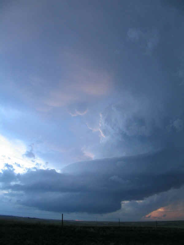
The show continued for over and hour, from around
7:00 PM to 8:20 PM Mountain Time, leaving Scott and I in the silence
that an awesome storm dictates. The only sound we heard was rapid inflow
and the electric whir of our camera shutters. Several times scud
attached to the base and began organizing, but the inflow was cool and
dry by this time and tornadogenesis was impossible. We didn’t care.
Of course I wish we’d gone to Denver and seen all the tornadoes. Earlier
in the day, in fact, Scott Eubanks joked about a likely Denver outbreak
since we were passing up Colorado for southeastern Wyoming. As they say,
sometimes the bear eats you. But our consolation prize tonight was a
fine one—a breathtaking high plains LP in the beautiful open ranges of
Wyoming. Many thanks to Jeff Gammons and Steve Miller for great
nowcasting.


"SEVEN YEARS ON CYCLONE
ROAD" DVD (click DVD for info)